
Gellibrand Gravel Loop
The Gellibrand Gravel Loop is a good sampler of some Otways Gravel.
Stats
The route is 38km long and has 680 vert metres. My time of 2:04 was ridden at an average speed of 18kmph.
Course Terrain
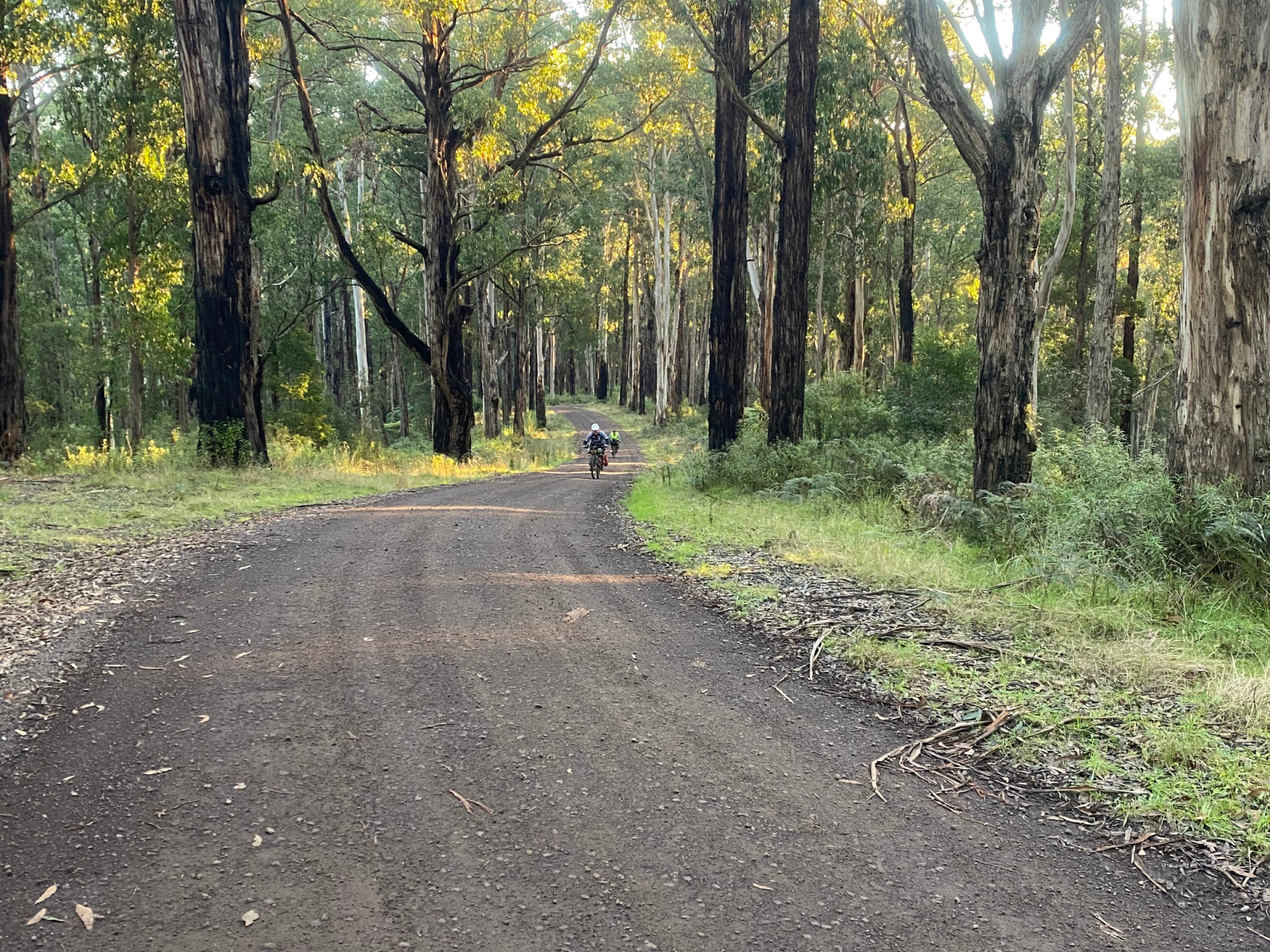
There's a short section of bitumen to take you to Roadknight Creek Rd at the start of this ride. The rest is decent gravel roads with some climbing.
Course Route
Leaving from the main street,
- Leave Forrest via Turner Drive, next to the Brewery and ride for 1.3km.
- Turn left when it intersects the Colac-Forrest Rd and ride 1.5km.
- Turn left at Roadknight Creek Rd, ride this for 5.8km.
- Take a right turn onto Ridge Rd and ride for 9km.
- Turn right onto Kawarren East Rd and follow for 3.5km.
- Turn right onto McDonalds Rd. This continues for 4.6km but note that to follow it, it does feel like you're taking a left turn at one point - but to go straight would take you onto private property.
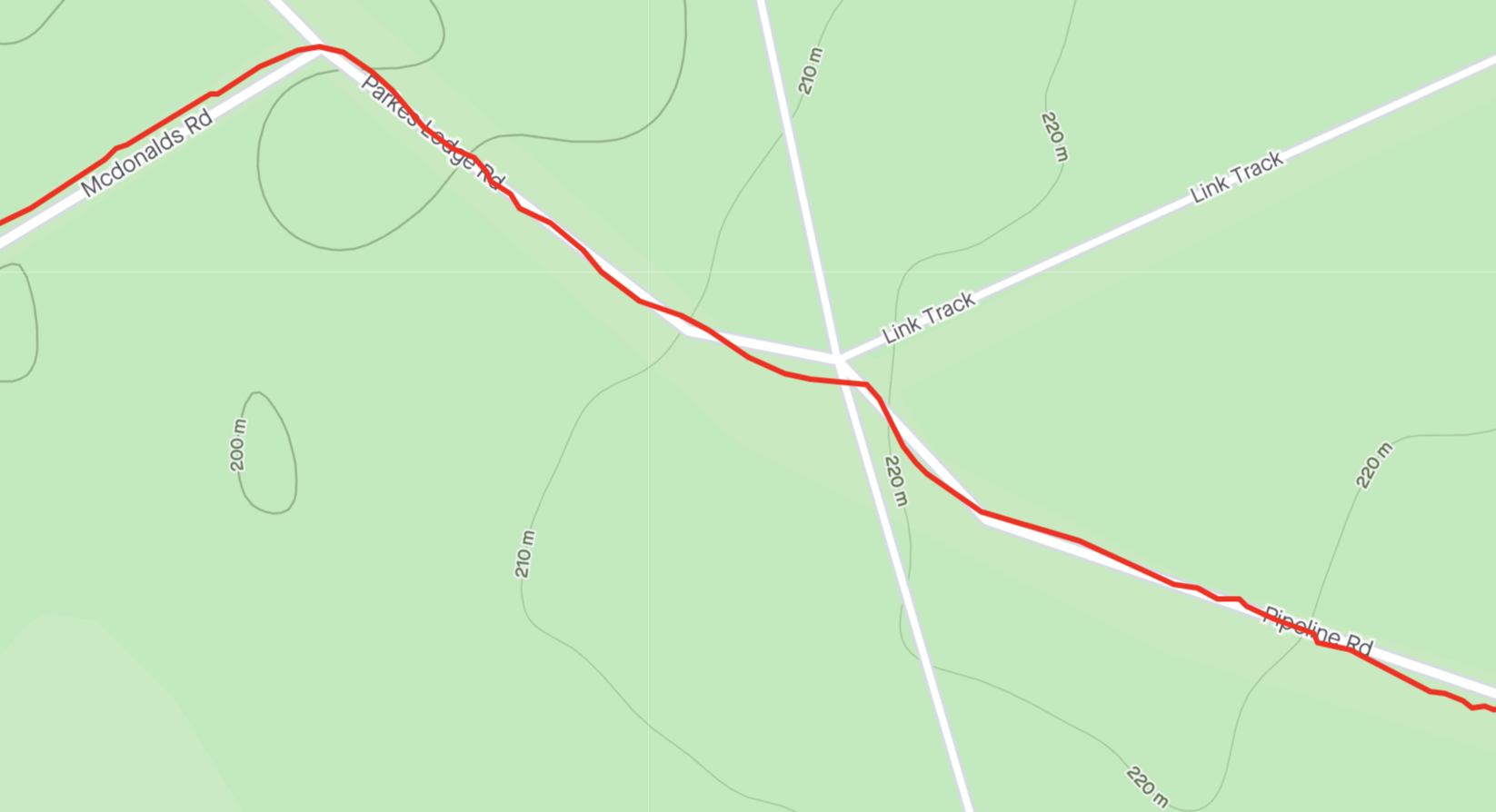
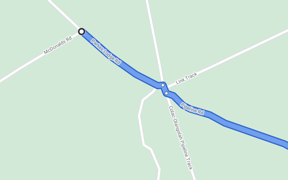
- Turn right onto Parkes Lodge Rd. In a short distance you will reach an intersection with three roads/tracks crossing. Take Pipeline Rd which is almost a straight continuation of Parkes Lodge Rd.
- Follow Pipeline Rd for 3.6km.
- Turn left onto Boundary Rd, and follow it for 6km. Take care crossing the Colac-Forrest Rd. Boundary Rd takes you past the Yaugher MTB Trail head.
- Continue on Boundary down to the main road back into town (Birregurra-Forrest Rd).
- Cross over the Birregurra-Forrest Rd to the other side and take the small piece of singletrack. Note: You can just turn right and ride the road back into town instead.
- The singletrack spits you out on the Tiger Rail Trail.
- Turn right and follow the Tiger Rail Trail back up into town for 2km.
Tips
Strava lists two roads as Pipeline Rd which is confusing as they intersect, however it is clearer on Google maps. Here is the intersection shown on both formats. You need to take the labelled Pipeline Rd on Google, not the one labelled Colac-Olangolah Pipeline Rd.


| Route Name | Distance | Vert Metres | Loop/Point to Point |
|---|---|---|---|
| Thompsons Loop | 31 | 830 | Loop |
| Pipeline Track | 25 | 646 | Loop |
| EC Loop | 39 | 870 | Loop |
| Kawarren Loop AC/ | 48 | 850 | Loop |
| Forrest to Apollo Bay - Sunnyside Down | 50 | 880 | Point to Point |
| Barramunga Loop | 20 | 430 | Loop |
| Dewings Bridge Loop | 26 | 320 | Loop |
Forrest to Apollo Bay – Sunnyside Down
Forrest to Apollo Bay – Sunnyside Down This is one of my favourite ways to get to Apollo Bay…. if you haven’t ridden Sunnyside Rd, you need to pop it on the list. The section leaving the Forrest-Apollo Bay Rd is just stunning forest with tall slender gums and ferns everywhere. Once Sunnyside intersects with … Read more
Read More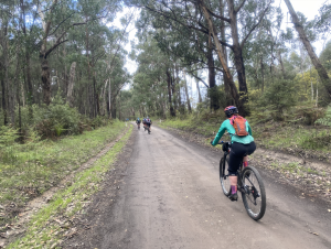
Kawarren Loop AC
Kawarren Loop AC The Kawarren Loop AC takes in a variety of views as you wind out of town through paddocks. Following a section of the Old Beechy Rail Trail, you will find yourself rolling down green gullies and past points of historical interest. From Kawarren East, you head back up into the dry Eucalypt … Read more
Read More
Thompsons Loop
Thompsons Loop Stats The route is 31km long and has 830 vert metres. At an average speed of 13.5kmph, it will take approximately 2:18 hours. Course Terrain This loop track will take you right up into the Otway ranges, through the tall gum forests, overlooking steep mountain valleys. The first 13km is a steady climb … Read more
Read More